
“O’ Canada, Our Home and Native Land.”
Posted on Thursday, February 25th, 2010
In watching the opening ceremony of the 2010 Winter Olympics in Vancouver, I got chills witnessing the roll call of the Native Tribes of the “Land of the True North.” What a beautiful and fitting tribute to these original people of Canada.
Everyone knows something about these original people and their culture. What I believe we don’t know and don’t appreciate is how large their populations were in ancient times and how advanced they were technically. This posting is intended to open minds to those possibilities. I would like to point out two features only visible from high altitude and then direct you from the coast of British Colombia to these locations in Alberta, Canada.
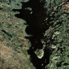
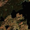
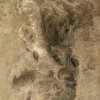
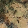
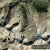
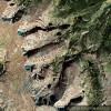
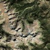
Feature # 1: A Checkerboard Pattern located at Greenview #16 Alberta, Canada (Note the absence of roads to this area). Directions: “Google Map” Grand Prairie Alberta Canada. Then South east of Grand Prairie at 5 o’clock-Down approximately 50-60 miles halfway between Hwys # 40 & 43 Â 20 miles North of Fox Creek, Alberta.
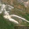
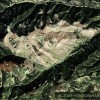
Feature # 2: A Massive Grid Pattern located at Swan Hills, Alberta Canada (2008 Population -1,858). Directions: “Google Map” Swan Hills, Alberta Canada. Zoom out to 5 to 10 miles as per legend at the bottom left.
What does the Checkerboard at Greenview #16 and the Huge Grid at Swan Hills represent? How about the discoloration dots that cover the landscape in these parts of Canada? Could those dots be evidence of ancient farms and homesteads that were discolored by centuries of farming and fertilization?
I invite you to take a “Google Map” trip and you will see the huge number of possible settlement marks.
- Go to Google Maps and type in Prince Rupert, Canada- (Press Enter)
- When the screen shows Prince Rupert back out the picture to 5 miles per inch shown in the bottom left corner of the picture
- When you arrive at the 5 mile per inch picture you will clearly see Canadian Hwy # 16. Proceed east on Hwy # 16 by depressing your cursor and dragging the picture in that direction.
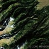
- When you pass through the mountains you will begin to see various shaped discolored dots(possible farming or settlement sites) Less you think these may be modern farms or settlements look how many there are and how far they extend beyond any roads. However, there are also modern day cities, settlements, and farms along this path as well.
- Proceed past Prince George    You will go through white mountain areas.
- When you get to Brule Lake stop. Go down to one mile per inch and spend time looking at all the lines and line patterns. Check out the dark green lines against the light green pattern on the north side of the river on the north end of the lake.
- Go pass Hinton and down to Hwy # 43. Proceed north on Hwy # 43. I believe you will be amazed at the number of discolored markings.
- Proceed on to Hwy # 40 and then proceed south. If those discoloration dots are in fact settlement marks you may have just passed through one of the most populated areas of ancient times. Coincidentally, it is now a sparsely populated area of modern Canada.
I could be mistaken in what these marks represent. The checkerboard, the huge grid and the settlement dots do deserve to be explained. What are they? What do they represent? If you have any opinion on this please let me know.
To view please click on links below:
The Beak of the 10th Sun Raven STILL GLOWS!



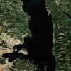
The checkerboard pattern is most interesting.