
Inconvenient Maps at the Library of Congress
Posted on Friday, January 29th, 2010
Today there are at least three and quite possibly more “Inconvenient Maps” at the LOC. These maps are inconvenient because they do not support the history of the world or the history of the United States that is currently being taught. I believe that The Library of Congress knows better but seems to be supporting the old official version. The three Inconvenient Maps that I know of are:
1)Â Â Â Â Â The Asian map that is owned by the LOC and mentioned by Charlotte Harris Rees in her press release. Charlotte has eloquently stated her case on this matter herself.
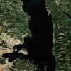
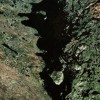
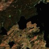
2)      A European Map positively dated to 1533 on vellum of an approximate size of 10”x14”. This map in satellite photo detail is of all of South and Central America and about 2/3s of the way up to the Canadian border of what is today the Unites States.
3)Â Â Â Â Â The Waldseemueller Map purchased by the LOC in May, 2003 for the sum of $10 million dollars. (The European Discovery of the Pacific)
Without doubt the LOC has the finest map collection in the world. Scholars from all over the world come to study these maps.  Recently I asked the LOC for information about map #2 that I and several members of my family have personally seen on two separate occasions on tours of the map vaults occurring at the LOC in 2003 and 2005. The individual who introduced us to that map on the first tour and who also reproduced it at my request on the 2nd tour is now claiming that he has no idea what I am talking about when within the last year we personally corresponded about that very map. How do you explain his involvement on the two occasions we toured the collection and his current lack of memory of the 1533 map he showed us twice?
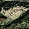
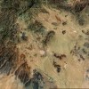
Why would the LOC do anything like that? Any answer I would give would be speculation because I do not know. I do know that if the LOC officially acknowledged this map mentioned in “Secret Maps of the Ancient World” on page 7 it would pose a problem for those who believe that the Europeans arrived in North America first. This map #2 was positively dated to 1533 and is in incredible detail. It was done in the European style by a European HUNDREDS OF YEARS BEFORE ANY EUROPEAN HAD EXPLORED MUCH OF THAT AREA.
The map is in breathtaking detail. Every nook and cranny in the Baja pennisula was in high detail as was the rest of the map. Assuming that this was not a duplication of an aerial image it would have taken decades if not centuries of refinement after refinement to produce such a detailed map. Unfortunately it seems to have disappeared in the archives of the LOC. It is an extremely inconvenient map to explain.
But we are in luck because map #3 in the LOC collection cost them $10 million dollars and that  map would be much harder to misplace for obvious reasons. They bought that map because it is the first known map to have the name America on it.
Why is the Waldseemueller Map inconvenient? Waldseemueller, the German cleric who crafted (COPIED) this map in 1507 did it under mysterious circumstances.  He either drew this map by divine revelation or he copied someone else’s work. (…. How Did He Know What He Knew) Let’s put his map in historical context. The first European to personally see the Pacific Ocean was Balboa in 1513. That was 6 years before Magellan sailed into it in 1519. How is it possible for a German cleric mapmaker to produce a map showing the Pacific Ocean years before any European knew about it MUCH LESS MAPPED IT! It gets better. Waldseemueller had no idea how accurate his 1507 map really was. How could he? A few years after 1507 under severe criticism by his fellow map makers, who considered Waldseemueller’s work ridiculous because of their ignorance, Waldseemueller himself apologized for producing such an ill informed map and went back to producing the same crude maps that he had drawn before 1507.  If this had been Waldseemueller’s own work why would he not have stood by it in the face of criticism? The fact that he folded on this issue indicates that he also had no idea what he was dealing with. Here’s another detail about Waldseemueller’s map. For centuries prior to 1507  Chinese mapmakers had been using a block style format as the surface for the maps they were making for several very important reasons that made their maps much more accurate. (The Genius of China by Robert Temple pages 30 – 34). Waldseemueller used this format to make his 1507 map? It was the Chinese block style format.
A curious phenomon occurred in the years from about 1470 to 1550. Maps just like the Waldseemueller Map and Map #2 started appearing in Europe. They appeared abruptly and disappeared just as abruptly into private collections as they were repudiated, by the mapmakers at that time. Today we can see how accurate those maps were. What happened? The Map that Named America
Have you ever wondered why it seems like every European who had an ocean going vessel became an explorer/discoverer in the late 15th and early to mid 16th century? Why this incredible rush to the sea? Was this just a coincidence? Why now did these seafarers have the courage to forage so far out into the deep? Did it have any connection to these incredible maps that were now showing up in Europe? I believe the answer to the last question is yes. These maps are what I am calling the Inconvenient Maps because they positively point to an outside source for the incredibly detailed accurate information on them.
If your objective is to prove European superiority in knowledge and seamanship and bragging rights as to which culture put an advanced civilization in North America first then these Inconvenient Maps pose a challenge as they can hardly be explained away. Who originated the source documents (original maps) used by the Europeans to create these new short lived European produced maps? How long and to what extent had they been mapping? For the answers to these questions again I direct you to The Genius of China and the sections on Chinese cartography and ship building. Then you can make an informed decision for yourself.
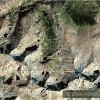
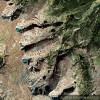
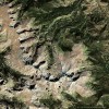
I believe to understand what happened in Europe during this time you have to stand back and look at what had happened globally just prior to this surge of information to the western world. Too often China is not included in the world history. Most of what we are taught is the history of western civilization. That is our culture and that is where our primary interests lie. That’s a natural response. However, if you want to know the truth then you must be aware of what’s going on all around the world. It’s a small planet now and it was a lot smaller in ancient times than we’ve been taught. (Look at the hippopotamus, baboon, gorilla and parrot geoglyphs carved into the mountains at Longs Peak, Colorado. International travel must have been far more convenient in ancient days than we’ve believed.)
In 1433 the Ming Emperor of China declared China the center of the world. This decree ordered all Chinese merchant families to stop trading with the rest of the world, destroy all maps as well as anything that did not pertain to China herself or what China absolutely needed. Failure to comply would result in the death of that person and their families. This decree of isolation in my opinion started China on a slide into its own 500 years of Dark Ages just as Europe was beginning to emerge from its Dark Ages/Middle Ages period and move forward into the Renaissance. The effect of this decree on China’s international trading families cannot be overstated. Can you imagine being ordered to destroy maps, inventions and other proprietary information that had made your family rich and had supported your family for hundreds of years? It was a nightmare. (Read “1434” by Gavin Menzies)
My theory is that rather than destroy this precious information and praying that the Emperor’s decision would be rescinded soon these documents, plans and drawings were boxed up and sent to family members and or trading partners in Southeast Asia to be held in trust until the sender could return for them. The decision was never rescinded and the senders never came to reclaim their boxes. At various times the holding parties opened the boxes and either used the contents themselves or sold it on the open market for the best price they could get. Over time this extremely valuable information began flowing into Europe and causing Europe to have to deal with it. The timing of the arrival of this advanced information could not have been better for Europe. Europe was ready for growth, expansion and discovery. It was this flow of information into Europe that led to the:
1) Maps used by Waldseemueller and the other makers of the Inconvenient Maps
2) Spanish obsession with the search of the cities of the Eastern Mountains and the nearby gold mines (El Dorado) as well as more information on the Chinese Elixor of Life which the Spanish translated as The Fountain of Youth and
3) Credit given to Leonardo di Vinci for inventions like the rotating helicopter blades and parachute etc that are known to have been in China for centuries prior to di Vinci’s purported inventions. (Leonardo di Vinci was a fabulous artist no doubt but I suspect that his supposed inventions had an undisclosed “Made in China” theme to them.
Too much of world history is analyzed as simply separate events in different places. However, if we go on false assumptions such as the inability or unwillingness of the ancients to travel extensively then our theories may be flawed at their foundation.
Example: Admiral Zheng He, his father and grandfather were Muslims. His father and grandfather were Hajis which meant that they had somehow traveled from China to Mecca and back in the mid to late 14th century. How did they do that? How common were such trips? Because Europeans weren’t making these trips doesn’t mean they weren’t being made by others. Zheng He
The Beak of the 10th Sun Raven STILL GLOWS!


Chinese Discover America » Blog Archive » Ancient Chinese Science & Technology That Made The Discovery of America Possible says: December 16th, 2010 at 11:18 am
[…] is precisely why it took Europeans until the period between 1487 & 1577 (90 years) after The Inconvenient Maps and new navigational information and technology from China had shown up in Europe to develop the […]