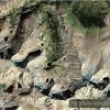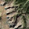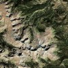
Satellite Imagery
Posted on Tuesday, October 27th, 2009
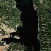
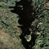
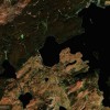
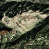
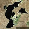
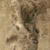
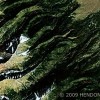
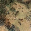
Satellite imagery has opened a major area of exploration. Now you can see the source data, the actual earth surface. It’s not another man’s interpretation of what he thinks is relevant. You now get to see the whole world. A few mouse clicks take you quickly around the planet and allows you to get in incredibly close where you desire.

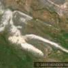
Granted the satellite photos available for our viewing, as opposed to the government’s real time views, are several years old. Several years hardly matters when you are viewing archeological sites from the air. It’s amazing what you can see from above and equally amazing that everyone who can make it to their computer can zoom in on the remotest parts of our world, be there in seconds and never leave a footprint. Satellite imagery has given us the world’s surface to explore and discover. Become an explorer, a “watcher of the skies”. Learn how to view satellite imagery. It’s only as far away as Google Maps and your computer. You can do it. If you find this information useful communicate your thoughts with me so I can respond to your questions and comments. If you wish to be taken off our email list please click the following box.
The Beak of the 10th Sun Raven STILL GLOWS!