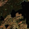
Ancient Flathead Lake Area Heavily Populated
Posted on Monday, June 7th, 2010
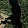
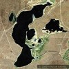
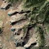
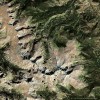
Location: Flathead Lake, Montana
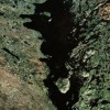
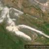
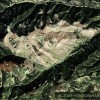
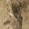
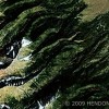
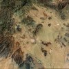
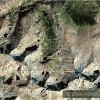
In a previous blog I have shown satellite photos of the approximately 1 mile square grids in the valley just to the east of Flathead Lake. Today I am posting images of the same type grids to both the area south of the lake and also to the west and extending westward. It’s highly unlikely that these 640 acre grids were done recently for one thing because they are in the national forest and for another who recently would have had the motive to spend the time and energy creating these dozens of enormous squares.
On the other hand it is well documented that in the 2nd Century and earlier the Chinese had a quantitative grid mapping system that was just like the images you are looking at now. What other plausible explanation is there for these grids? It can’t be unrelated  that the Flathead Lake Montana area is so close to Alberta, Canada where there is also literally mountains of evidence indicating a massive ancient population center.
The Beak of the 10th Sun Raven STILL GLOWS!